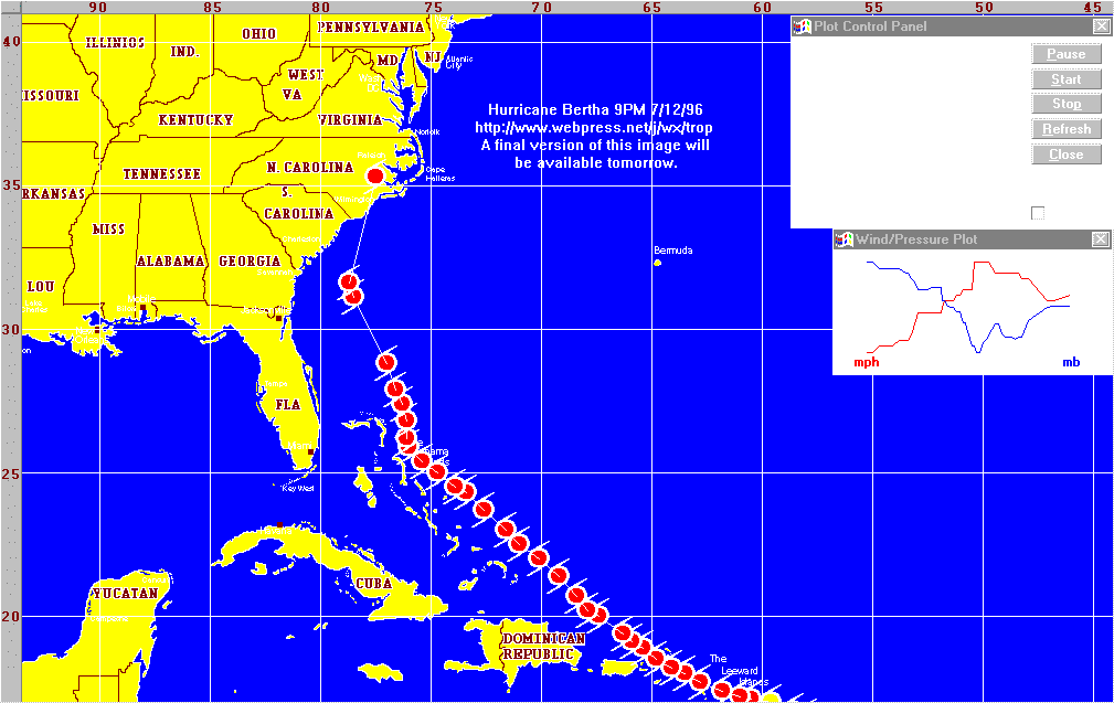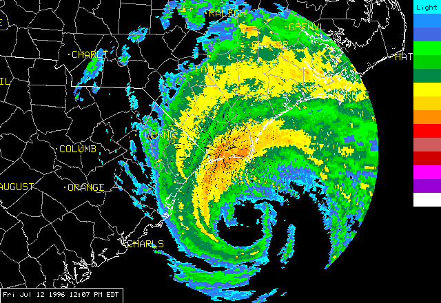

Just got back from the beach. Full report later today.
Bertha has now been downgraded to a Tropical Storm and is now centered
over New Jersey. Reports coming in summarize that most of the damage in
NC has been near Carolina Beach, Atlantic Beach, Kure Beach, and
especially Emerald Isle and Topsail beach. The southernmost beaches did
not suffer as much damage as was expected, and all islands in southern
Brunswick county have reopened except for Bald Head Island. The
following areas are closed to residents and non-residents until Sunday
evening at the earliest: EMERALD ISLE, KURE BEACH, CAROLINA BEACH, TOPSAIL
ISLAND, ATLANTIC BEACH. At the peak of the storm, 400,000 people were
without power in NC, now that number is down to about 100,000. I am
heading towards Long Beach to check on an oceanfront beachouse that my
family owns, and upon return this evening will be working on a report on
the life of Bertha. If you re going to the NCcoast today, for any
reason, keep in mind that the following items will be in very
short supply: Batteries, film, bvideotape, fast food, water. So
bring enough to last you through the day.
Results of a trip down east to assess the current situation show power out over most of eastern North Carolina, trees down over the eastern half of north carolina, and presumed devestation on the islands of SE NC. Bertha is still a hurricane, centered near New Bern, NC and is rapidly leaving NC for good. Television reports note that several piers along the SE NC coast were destroyed and that 150,000 NC Residents are without power at this time. People with houses and businesses on the beaches or barrier islands are asked not to return for damage inspection this weekend, as the areas will be CLOSED until Monday. Stay tuned to this page tomorrow for a full update and summary of Hurricane Bertha, including my findings on my trip to the beach Thursday and my trip to the coastal plain this evening. Thanks to all the visitors who came to this page and I hope I can keep you as well informed when the next storm occurs. --Jesse Ferrell

It would appear that the worst of the storms (if not the wind) are over
for the Raleigh area for a few moments, however hurricane bands, some
with more severe weather, will swing through the area throughout the
evening.
The Weather Channel reports devestation in Wrightsville Beach as the
eyewall skirts the coast. Net sites at Wilmington are down.
Possible funnel in Garner. Power blinking out in South Raleigh.
Considerable damage reported in Myrtle Beach and Brunswick County.
Much damage at Carolina Beach. Assuming outlying areas and islands are
devestated.
Part of a roof blown off in Johnston county
Severe Thunderstorm Warning for western Wake County, NC.
Near Maynard Rd., Raleigh NC Trees down.
Reminder: The Raleigh SKYWARN network is now active on 146.880 on your
scanners.
Two tornadoes have been spotted east of the city of Raleigh near the
county lines. Reports from the Wilmington area indicate no power at
Carolina Beach, that the power has been shut down at Wrightsville Beach,
and that numerous trees are down in the southeastern counties. Many
sites on the Internet are now saturated with extreme amounts of traffic
as people try to obtain the current conditions of the weather.
Wilmington sites are down for obvious reasons.
The heaviest rain is currently hitting southern Brunswick County, North
Carolina. The storm has increased in strength to 105mph, and is
beginning to reform an eye. The eye should make landfall near the NC/SC
border during the next few hours, though most of the fury of the storm
will be concentrated to the NorthEast of this.
The latest statement from the Hurricane Center shows that Bertha's
pressure has fallen and winds have increased.
At 2pm today, Bertha should make landfall near Myrtle Beach or Charleston. From there it will travel through the Raleigh-Durham area bringing several inches of rain and winds from 40 to 60mph, especially to the east of RDU. On the NC Coast this morning, noone is being allowed onto the beaches or barrier islands this morning. HEADLINE: 2333 EST 7/11/96
Somewhat weaker and more slow moving, Bertha is beginning to spin heavy
rains and high surf onto the beaches of NC and SC. Best chance for
landfall is now in South Carolina early afternoon tomorrow. See my
report on A Road Trip to Long Beach,
NC this evening.
Heavy rains and high winds are beginning to affect the carolina coast.
Still plan for Bertha to hit tomorrow late morning near Wilmington, NC.
Mandantory evacuations have taken place in all barrier areas of the NC
coast.
Bertha has begun to weaken, or so it would seem. A reminder however:
hurricanes of this strength and size are unpredictable both in their
movement and in their intensity, so let's keep an 'eye' on it. New
strike probabilities and a complete statement from the National Hurricane
Center will be issued at 5:00 EST today.
Not moving much, Bertha is also not changing intensity at this time.
Highest probability of strike is near the NC/SC border.
Landfall expected near Wilmington, NC early afternoon tomorrow. High
winds and heavy rains to overspread the eastern Carolinas.
North Carolina seems a sure hit at this time. The storm is slowing
down. Hurricane Warnings have been extended into Virginia. Landfall
at this time is estimated to be in SE NC Friday morning.
Voluntary evacuations are underway for the NC/SC/GA coasts, except for
easternmost NC where the evacuations are mandantory. The storm is
slowing down and meandering around. Let's hope that it doesn't stay
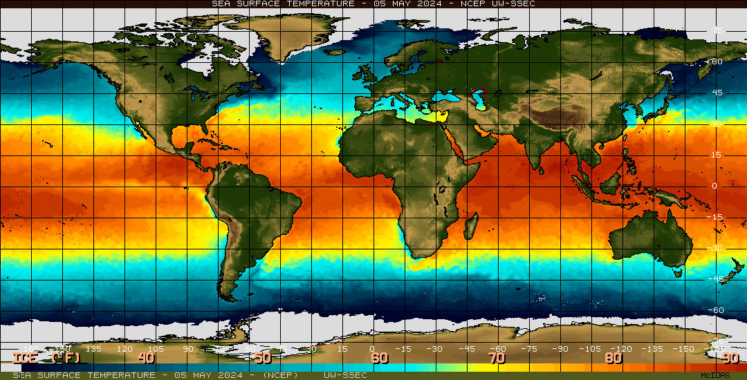
there long, as right now it's about to move over the Gulf Stream, which
is considerably warmer than the surrounding sea.
Hurricane watches have now turned into warnings for the carolinas
and Georgia. The storm has started turning slightly to the North
as a pronounced upper level trough swings in from the north.
Still, the forecast is uncertain. It appears that, perhaps,
instead of being "kicked out" by the trough, it may get stuck under
the trough as it works like a gear spinning out in the Atlantic.
If this is so, further strengthening could take place. Already,
pressures have ast have started to fall once again. Do check out
CNN's
Forecast Maps.
Hurricane Watches are now up for the Southeastern U.S., as the storm has
not yet turned to the North as was expected.
Hurricane Warnings continue in effect for the islands only,
although a watch is expected to be issued for the Southeastern US coast
by 11 tonight. The first trough swinging around the upper low failed to
effect the storm, and the fear is that the second will also miss Bertha.
It is still too early to say. A continuation of the current track would
bring it to around Savannah, GA by Thursday. Considering that it
is expected to change course to the North by tomorrow, a better
bet would be South Carolina, or the Outer Banks of North Carolina which
jut out considerably more than the surrounding geography and tend to get
clipped by passing hurricanes.

Winds constant, pressure rising. All changes
are negligible at this time. Has not turned to the North yet,
forecasters expect it to tomorrow. Meantime those with interests in GA
and the Carolinas should keep a close eye on the situation.
Cloudiness from the Hurricane could reach the Carolina coast as early as
late tomorrow afternoon if it continues on the current track.