
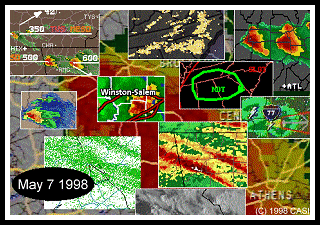
"In rural Caldwell County [North Carolina], Wade Smith was shaving when he saw his 1,500-pound bull slide across a field. His roof then blew just before he hurried to the basement with his dog."
--WRAL-TV
NEWS
CASI Member Larry Cosgrove, a meteorologist with WWOR-TV in New York, writes in his morning Storm Discussion e-mail list at 4am that fateful morning, "When I reviewed the latest short-range models, I double-checked them. I was taken aback by the dynamic and synoptic parameters that accompany the latest split-flow disturbance causing problems for the Ohio Valley and the Southeast States...Given the information I have regarding convective potential, I will forecast an outbreak of severe thunderstorms and tornadoes encompassing much of the Southeastern quarter of the nation today..."
Larry goes on to explain the dynamics that set the stage for the Supercells which were to develop later that day: "First of all, there is a growing surface low just south of St. Louis MO. Next, a strong jet streak exists from the parent upper trough in CA/NV into the extension shortwave in MO. Extremely unstable air is being intersected by dry cT mass at the midlevels, and the nearly circular 500mb system is advecting vorticity and helicity in great amounts across the system's warm sector."
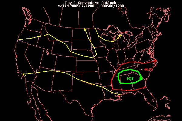
The SPC hit the nail on the head, when, in their 0600Z discussion, they predicted, "Believe current thunderstorms should intensify as they move into this unstable airmass across Georgia...South Carolina and southern portions of North Carolina. Latest models suggest vertical wind profiles over the region will support severe thunderstorm development with the possibility of supercells and a few tornadoes.."
By mid-afternoon, classic Supercells had formed over SE
TN, NE AL, and Northern GA. During the evening they slowly made their
way through Georgia into the Carolinas spawning several tornadoes and dropping
extremely large hail.
Severe Thunderstorm & Tornado Warnings
There were 95 Tornado Warnings issued for the Southeast United States on May 7, 1998. Click here to view a file containing all Tornado Warnings between midnight and midnight.
There were at least 170 Severe Thunderstorm Warnings in the Southeast with this outbreak. There were too many to get a complete listing. The following is what CASI has (if you know of somewhere that has all of them please let us know):
These are all the Local Storm Reports (LSR)'s from the NWS Offices. I have given links from the date of the storms (May 7) through several days later, as LSR's are often issued 1-2 days after major events when more details are known. If you need additional reports consult the LSR Archive.
Additional WWW Sites For More Info
These External sites contain articles about the storms. Starred (*) sites contain photos. Where noted, video is also available. Where possible I have tried not to repeat articles. "Greyed Out" articles were temporary and are no longer available. Thanks to all the CASI Members who contributed to this list of sites. If you know of additional sites, or if any of these links have died, please contact CASI.
MEDIA: