New Year's Wedge
1/1/97
A classic "wedge" sets up over the Carolinas for New Year's Day 1997. I remember it well; I was on a way to a friends house near dusk on Dec. 31, 1996 and saw some beautiful pockets of thick ground fog forming, some not 10 feet square. I wished that I had my equipment with me to record the event, but I was out for pleasure only, for a change.
I was worried that the thick clouds forming on the ground would mimick the last several weeks of widespread zero-vis fog and make the New Year's Eve accidents multiply. A wedge was on its way, however, and before 10pm the fog had dissapeared and it was clear as a bell and too cold for the shorts I had donned in the afternoon heat.
A "wedge," or "cold-air wedge," occurs over the Mid-Atlantic states when a high-pressure system over the NE US, with its clockwise circulation, forces cold air southwest into the Carolina area. The Appalachian Mountains block the advance of this air, and keep it from dispersing. The cold "pocket" of air can hang around for days until another system comes in to move it out.
Before the announcement on the Weather Channel, I could see the setup. Their prediction of the high temperatures on Wed, Jan. 1, 1997 would be about right. The wedge lasted until late on 1/2/97, bringing temperatures in the 60s to the mountains but 40s to the coast of NC!
Summary of the wedge (click on each picture for a larger representation).
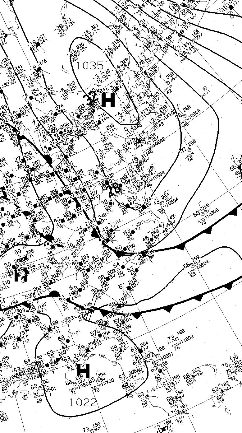 |
NWS Surface Map from 12Z on January 1 showing the advance of the Wedge behind the front over central North Carolina. Morning temperatures are below 0 in NY, in the 40s in VA, and near 60 in southern SC. |
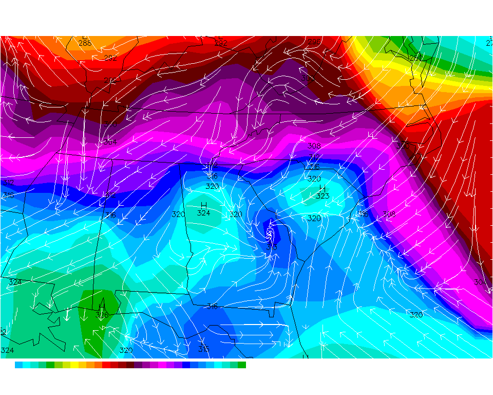 |
Theta-E analysis at 00 EST on the 1st clearly shows the beginning of the wedge (surface front) advancing through northeast NC. |
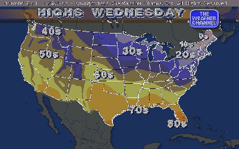 |
TWC Predicted High Temps for 1/1/97 show the wedge overtaking north central NC. |
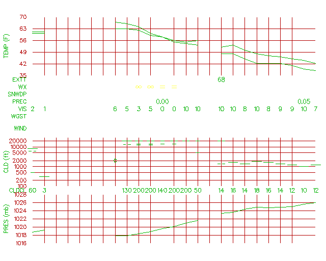 |
Meteogram for Raleigh, NC through 8am 1/1/97 shows the wind shifting from SW to Calm to NE when the front of the wedge pushes through. Visibility decreases to 0 around 00Z as the aforementioned fog begins to roll in, but vanishes in 2 hours to a visibility of 10 miles as temperatures begin to fall. |
|
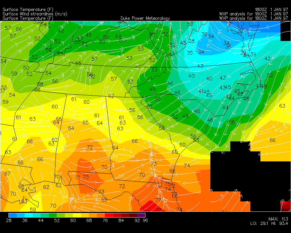
Temperature analysis over the SE US at 1pm
on New Year's Day showing the continued advance of the wedge into the Carolinas. |
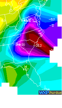 |
A look at the 24-hour temperature change over the Mid-Atlantic at 1pm 1/1 clearly shows the effect of the wedge, with local temperature drops of over 28 degrees since the same time the day before. |
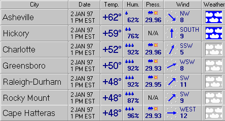 |
A look at surface observations illustrates the wedge
in place early afternoon on January 2nd. The temperature ranges from 62 degrees at AVL (in the mountains) to 48 degrees at HAT, on the outer banks, a complete reverse of the normal temperature range across the state. |

