Click on any of the links below to receive an actual image or text file!
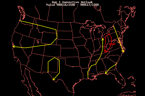
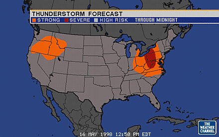
The storms formed very suddenly (see Nexrad animation below). Even after the SPC's issuance of a Slight Risk for the area (see discussion and graphic and TWC's own Severe Risk graphic) and the NWS-State College's issuance of a Special Weather Statement in the late morning, I was still doubtful that anything would form. It was 1:30pm and the radar scope was completely blank in the Eastern US. Nonetheless, a chance was a chance, and I sent out a mailing to the CASILIST to notify Members of the possibility of Severe Weather, which would be the first widespread outbreak of the year, if it happened.
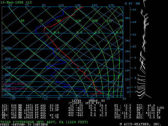
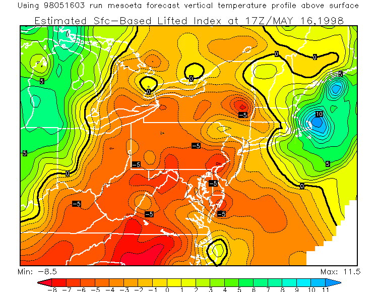
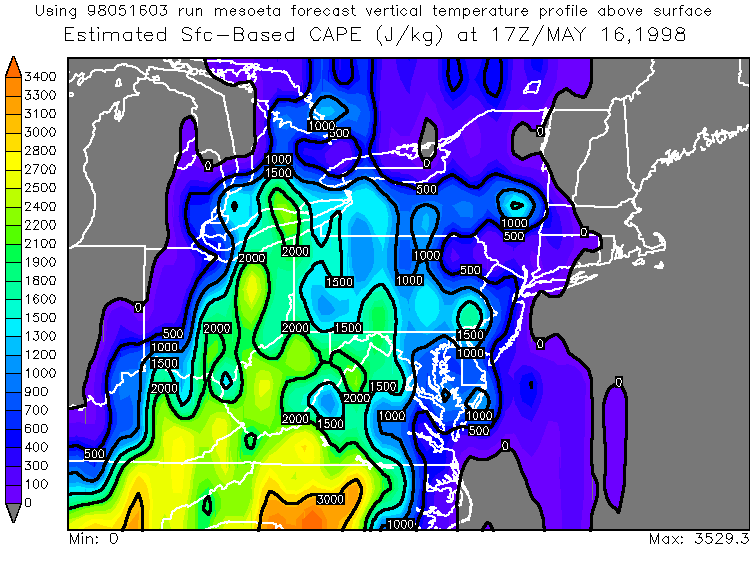
The morning SKEW-T from PIT was not that impressive... neither were the Estimated LI's and CAPE's at 17Z from the MesoEta, at least for the Slight Risk area. The more impressive numbers were in the Carolinas.
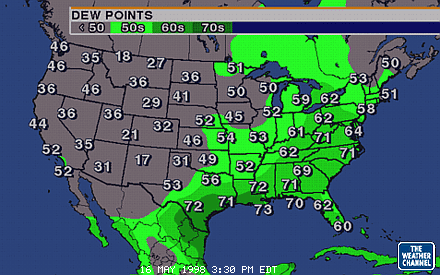
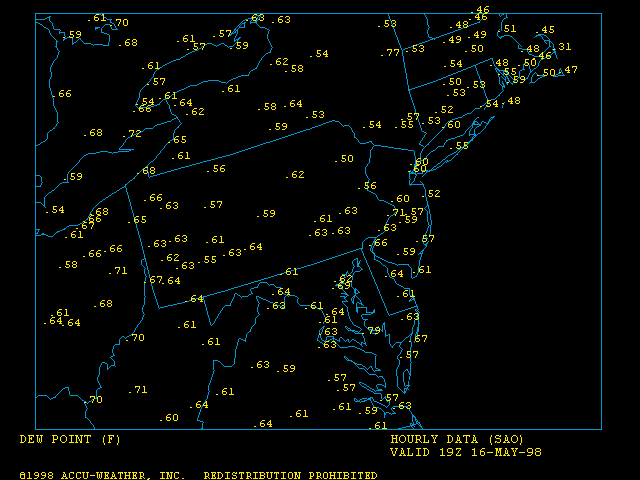
The one thing we did have in our favour was the Dewpoints. As depicted by the Weather Channel dewpoint map that day, dewpoints were in the lower 70's from Texas to West Virginia. Taking a closer look with a local dewpoint map, notice the upper 60's in Western PA, Lower 70's over West Virginia, and a very muggy 72 in Canada west of Buffalo. It never ceases to amaze me how often thunderstorms can explode in moist air even if other conditions are not that favourable.
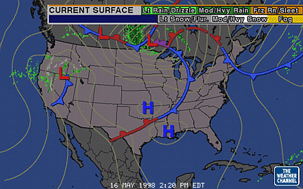
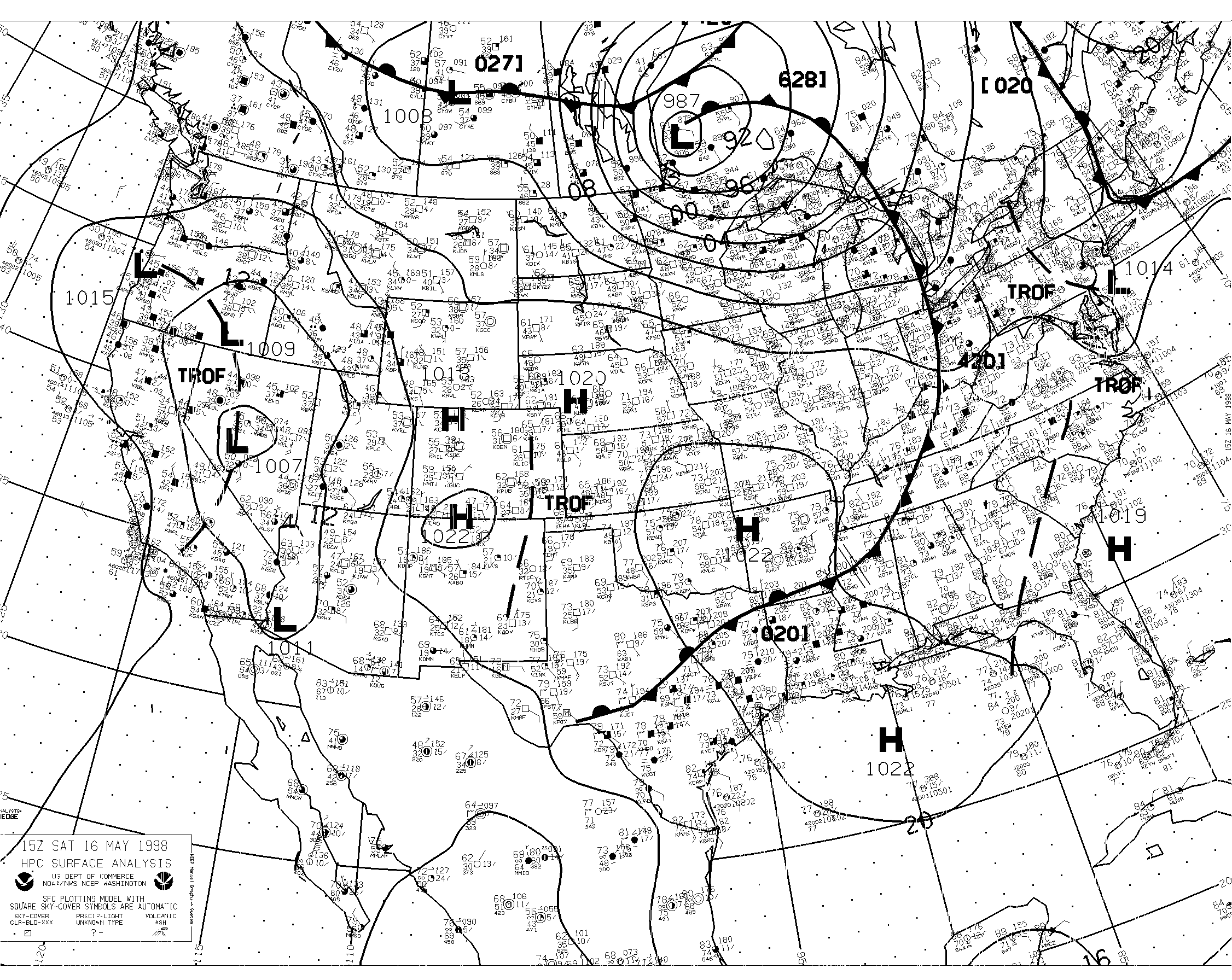
And of course we had the frontal system, hanging from a Low in Canada (see simple TWC Surface map or detailed Difax Surface map, both from 15Z).
Interestingly enough, this was the frontal system that was pulling up the smoke from the Mexico/Central American fires. On the satellite shots (see below) you can see the smoke. In the earliest shot you can see that the thickest smoke has made its way into Central North Carolina and stretches up to Western PA.
All day the haze was present at HeadQuarters in Central PA and it only got worse as the day went on. Visibility was limited to a few miles. This, along with the volatile nature of the storms (quickly forming and quickly disappearing) made this a very bad day for chasing. I did consider going out, but couldn't justify it. As soon as the first Severe Thunderstorm Warning was issued (see below for a list) it had to be dropped when the storm disappeared. This was not a day with a few clearly defined, constant direction, long-lived Supercells. This was a day with no visibility and dozens of small cells forming, dissipating, and reforming in another place. This being the East Coast, full of trees and hard-to-navigate roads, I could easily see myself leaving HeadQuarters (which has a nice 360-degree tree-free view, well, almost) and being trapped in traffic under 60 foot oak trees. Not to mention the only cell close enough for me to catch would have made me go right through downtown, something you want to avoid on Saturday.
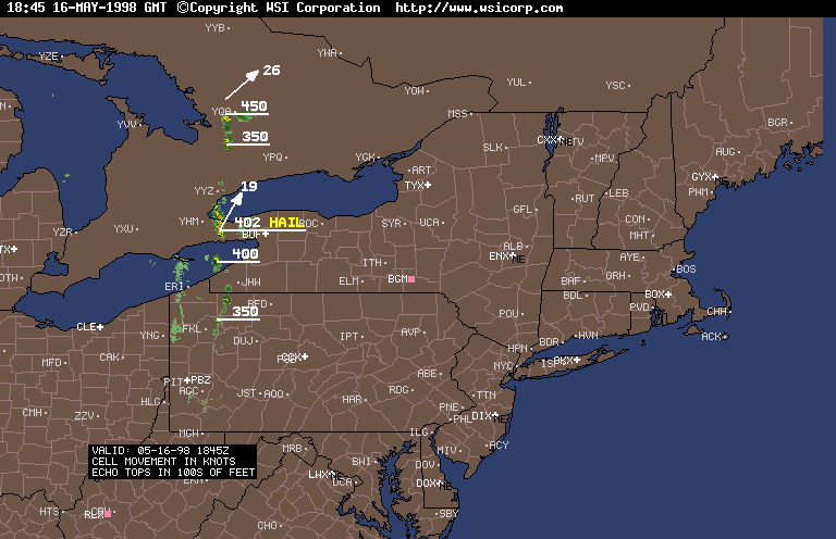
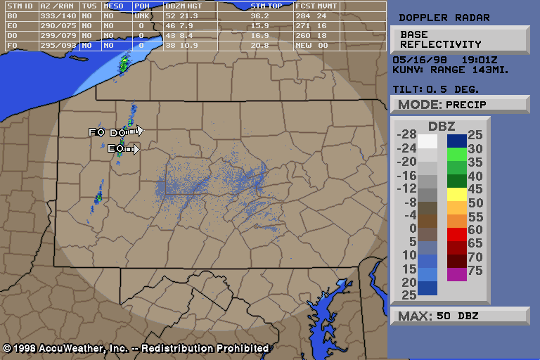
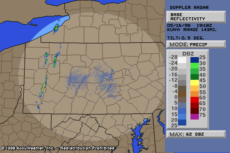
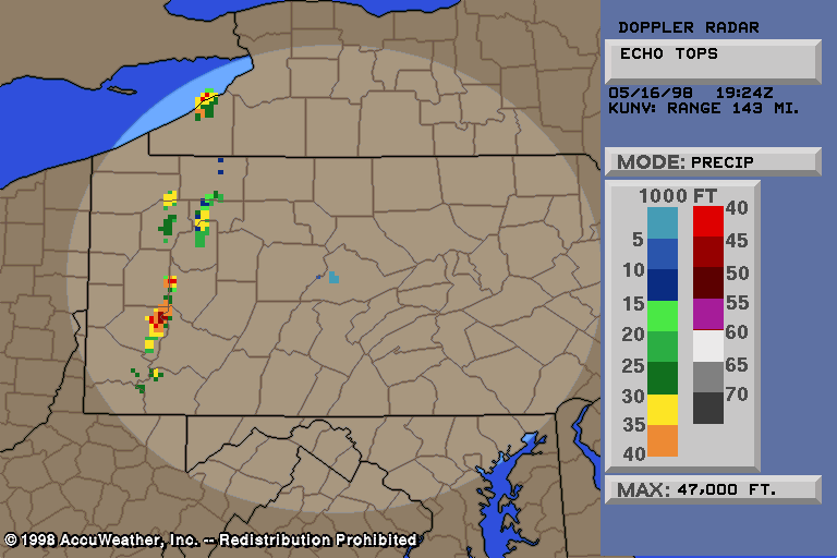
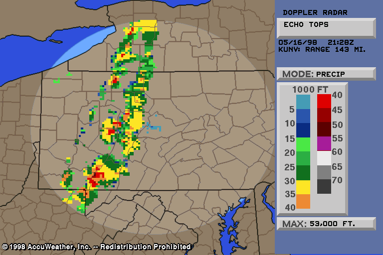
Anyway, at about 2:45pm the storms suddenly formed, the line forming down from the north, with nothing else around, as shown by the 2:45pm Radar Summary. The UNV Nexrad went from absolutely nothing at 2:40 to a line of storms of up to 52dbZ at 3:01pm (#1). By 3:18pm we had a 62dbZ storm on our hands (#2) and a few moments later UNV put the Echo Tops at 47,000 feet (#3)! It was clear that, as they say, "it was GO time."
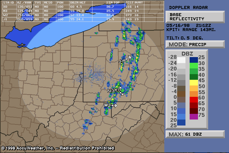
The line continued to gain latitude, and as it approached Central PA it was joined by another couple of choppier lines behind it, which could be seen nicely from PIT (#4).
An area of constant development appeared in SW PA around 4pm and held together very nicely. It was clear this was where the action was, and the Warnings came out:
SW PA Warnings:
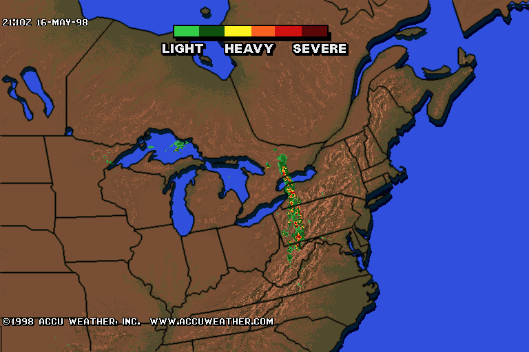
And that was the only action in the Eastern US! Check out the Regional Radar from 5:10pm.
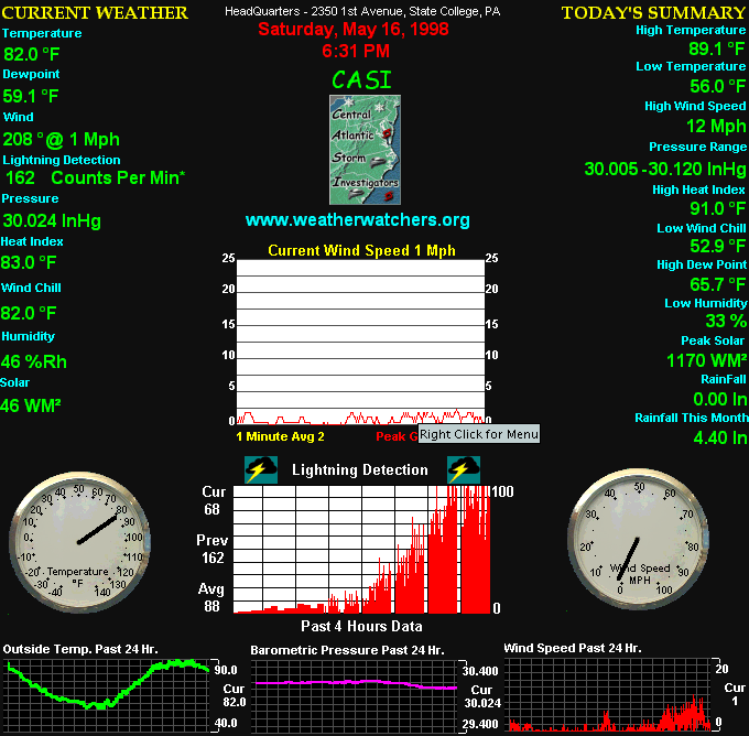
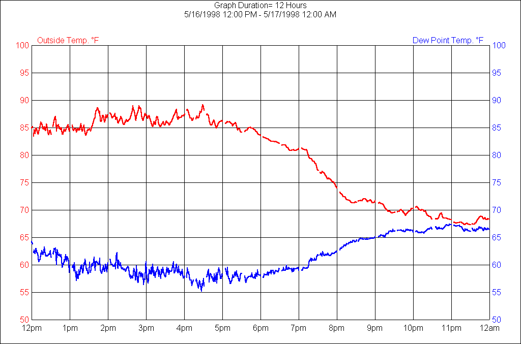
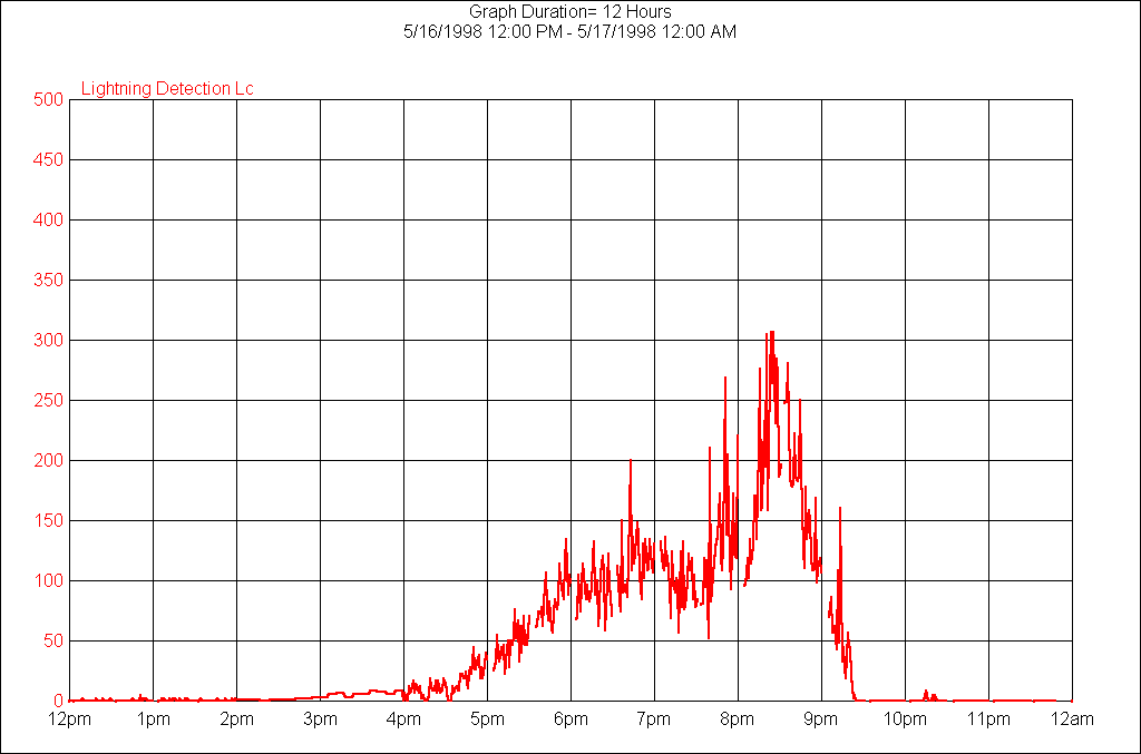
But I was more concerned with what might be approaching HQ... at 6:15pm the first line was approaching. My chase partner called from a few miles west. "You chasing?" I replied, "Yeah, I mean, No, I don't know!". I decided that due to my location it was best to stay where I was - with almost 360 visibility at HQ it's tough to justify leaving. There was a decent cell in the SW part of Centre county, nearer to him, and he thought he'd check it out... but for me that would put me going through town which would have been death at that time of day so I stayed put. Not to mention the volatile nature of the storms as previously mentioned, appearing and disappearing like so many overshooting tops. Thunder began to rumble and the lightning detector was taking off - reading about 100 counts per minute average. As you could see from the Conditions At HeadQuarters at 6:30pm, I had been detecting the lightning since before the storms formed (probably was detecting the NY storms as they formed). And with 82/59 T/Td it was about as juicy as PA gets in the summer.
Then a warning came out for the county to the west of me.
Central PA Warnings:
So I waited. And waited. And waited. Amazingly, I watched the line lose all the storms as it swung through Central PA. Watch on the Nexrad radar animation below as the storms dissipate over Central PA (HeadQuarters is at the dead center of the UNV radar scope). Watch an additional two lines form behind them and also dissipate. What a disappointment! My partner's storm must have been dying just as he got to it (SW part of Centre county, the county where UNV radar is). Observe the Lightning Animations as the lightning dies in Central PA but continues with the line to the N and S!
I finally got a little rain around 8pm as the third line dissipated through... then another line formed in NW PA but moved slowly and broke up later that evening, but not before a couple of warnings were issued. A storm formed in Montour county which gave Greg some lightning. The largest lightning detection strangely enough was around 8pm but thunder was very minimal - quieter than 6pm when the lightning detector had read 150.
Storm Log From HQ:
6:15pm - Some thunder. Storm in SW Centre county
heading ESE. VIL UNV 52.
6:30pm - Less thunder, but lightning at 150 C/m.
Storm to SW moving little
6:39pm - Taking some video. Still dark to NW and
some SW.
6:41pm - Partner's storm is petering out. This
is second line to dissipate. Line is still approaching but not arriving.
Possible descending air coming off mountains causing problems.
6:48pm - Max dBZ down to 55, VIL nonexistant for UNV,
course it is close to the radar site now. Partner's storm down to
40 dbZ or less. TWC claims 457 lightning strikes last 15 minutes.
Not looking good for us, folks, radar showing dissipation.
6:52pm - Classic supercells south of here in VA - wish
I were there! Only occasional thunder rumble. Wind continues
very light from the South, interesting.
6:59pm - Streamline chart shows an area of convergence
in east-central PA and its possible this line could refire then.
7:01pm - No thunder, no lightning. Sky still dark
WNW.
7:12pm - Finally a little rain from this thing, nothing
else. Well win some, you lose some...
8:10pm - Light rain, a little thunder. Lightning
detection is at 340 C/m, but no strikes near by. That's heavy C/m
for being nothing detectable by the eye...
See also data from the HQ weather station below for the period of the "approaching" storms.
Temperature/Dewpoint Graph, 12pm - 12am, 5/16/98
 |
Lightning Detection Graph, 12pm - 12am, 5/16/98
 |