
Central Atlantic
Storm Investigators
Central Atlantic
Storm Investigators
Thunderstorms
Nov 8, 1996
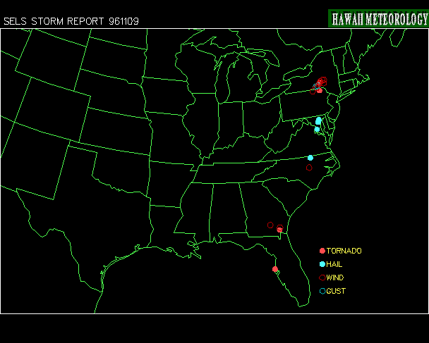

Post Storm Investigation (PSI)
The PSI for this weather event involved going over what weather images we had and re-watching the video for captures of the LSI.
The synoptic cause was a strong low pressure system over the NE swinging a powerful front through the Carolinas. This caused very warm southerly winds to advect extremely warm air ahead of the front.
What a nice summer (oops, it's November) morning in Eastern NC...

The Raleigh Airport was fairly windy all day, maxing out at 39mph during a heavy thunderstorm (see LSI report) at 11am:
KRDU - RALEIGH-DURHAM, NC

ID   TIME   T  TD  RH DIR SPD GST ALT SLP VIS CIL COV WX  MAX MIN  PR6 PR24 SC

KRDU 0702  72  66  83 190  16  22 990      10  15 OVC
KRDU 0751  71  67  87 190  13  18 987 113  10  17 OVC
KRDU 0851  71  68  90 180  14  21 984 102   5  14 OVC R-
KRDU 0951  71  68  90 180  13  18 983 097   8  14 OVC R-
KRDU 1051  71  68  90 190  12  20 981 090  10  15 OVC R-
KRDU 1103  72  68  88 190  14  22 981      10  13 OVC
KRDU 1151  71  68  90 190  12  20 980 087  10  15 OVC      72  71 0.40 0.40
KRDU 1251  72  68  87 190  13  22 979 084  10  16 OVC
KRDU 1351  73  69  88 190  15     978 080  10  18 OVC
KRDU 1451  73  69  88 180  11  19 974 067  10  23 OVC
KRDU 1551  72  70  94 210  14  32 971 058 0.5  13 OVC TR+
KRDU 1558  72  70  94 230  15     972     1.2  16 OVC TR+
KRDU 1605  72  70  94 200  17  22 970     0.8  11 OVC TR
KRDU 1651  73  70  89 190  16  25 966 042  10  26 OVC
KRDU 1751  73  70  89 200  18  31 960 020  10  26 SCT             0.90
Popcorn thunderstorms developed out ahead of the main line of rain during the late morning, and a small squall line passed through eastern NC just before noon. At 12pm, the Greensboro Airport reported a wind gust of 44mph (39 knots) in a heavy thunderstorm:
KGSO - GREENSBORO, NC

ID   TIME   T  TD  RH DIR SPD GST ALT SLP VIS CIL COV WX  MAX MIN  PR6 PR24 SC
KGSO 1700  66  64  94 260  31  39 965     1.0  21 OVC TR+
At 5pm there was no question where the front was with a 35-degree temperature difference between reporting stations in western and eastern NC:

Some pictures to illustrate:
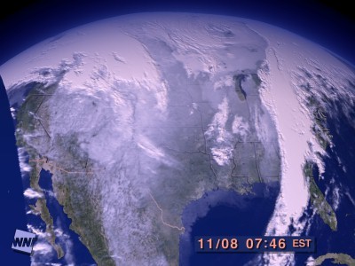 Satellite (8am) shows that storm was no joke |
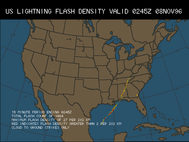 Lightning Data from late the day before shows pronounced line |
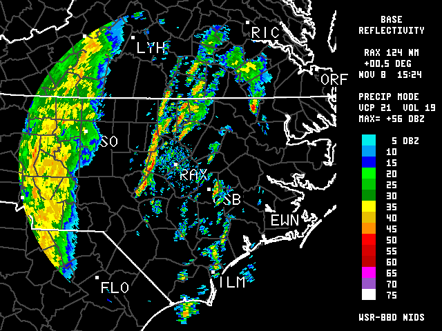 Nexrad at 10:30am shows line approaching |
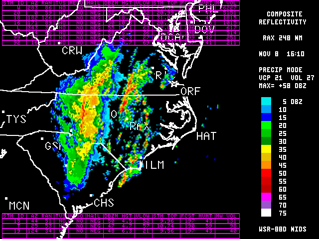 Nexrad Composite at 11am shows popcorn development ahead of the frontal system |
 Satellite Approx 11am shows line of storms moving through RDU |
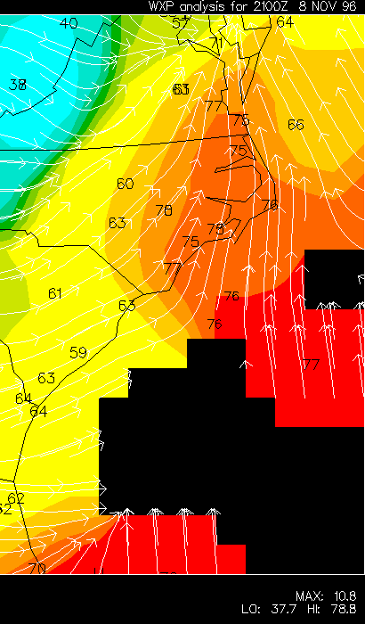 Even at 4pm, the southerly flow over eastern NC is strong (temps shown) |