
Central Atlantic
Storm Investigators
Central Atlantic
Storm Investigators
Severe Thunderstorms
May 27, 1996
Post Storm Investigation (PSI)
The PSI for this weather event involved going over what weather images we had (which were mostly downloaded upon returning home at 00:30 Local), and re-watching the video for captures of the LSI.
I have to admit that the storms looked promising approaching HeadQuarters, and they did not dissapoint. The most impressive map is the Nexrad Estimation on Precipitation for the period of the storms... the heaviest swatch of rain (up to 5") is exactly along the track we took for the LSI.
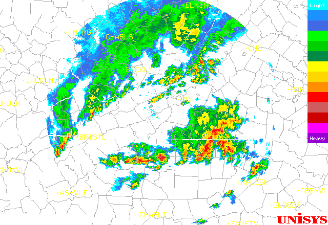 Raleigh Nexrad At Decision Time 6:30 PM 5/27/96 |
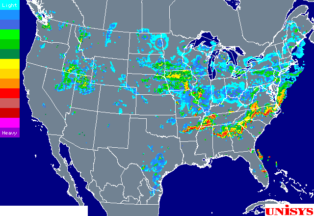 The Whole Line Is Nice! US Radar Composite 12:30 AM 5/28/96 |
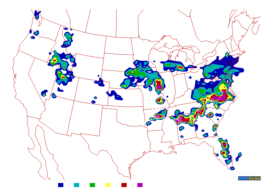 Radar Shows Us Socked In By Level- 6 8:30 PM 5/28/96 |
|
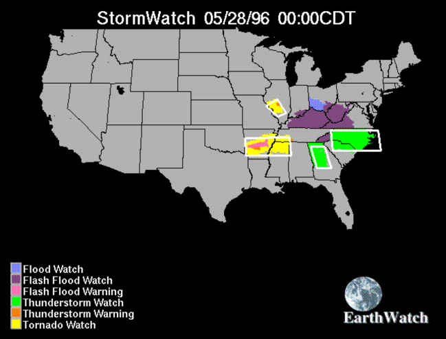 Severe TR Watch (Green) Was Good Idea 7:00 PM 5/27/96 |
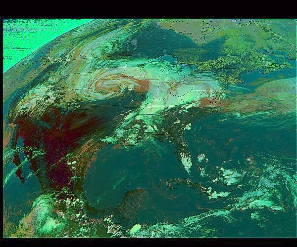 Storm That Brought Us The Severe Weather Was No Joke - US SAT ~3 PM 5/27/96 |
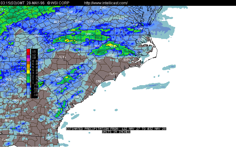 Nexrad Precip Est. Shows Up to 5" Rain Along Our LSI Route Through 10 PM 5/27/96 |
It is one of two things. We'd like to think that it is a leader coming up from the pole, however several factors dissuade us from this and mark it as a simple cloud-to-cloud strike which is eminating from the cloud behind the pole. First, leaders are fairly rare to capture on film. Secondly would be the obvious fact that the leader should be eminating from the top of the pole, not further down, unless there is some unseen metal object at that place.
A high-resolution capture does nothing to increase illustration.
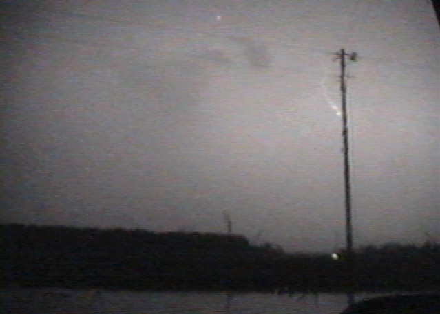 Lightning Bolt In Question |
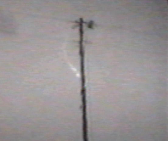 Zoomed Shot |