HandheldWeather.com by WeatherMatrix
© 2002 WeatherMatrix.Net - Redistribution Prohibited. Usage logged.
HandheldWeather.com by
WeatherMatrix
© 2002 WeatherMatrix.Net - Redistribution
Prohibited. Usage logged.
From: Jesse Ferrell (WeatherMatrix) 2 (jesse{at}weathermatrix.net)
Date: Sat May 10 2003 - 14:05:18 EDT
The Storm Predication Center has issued a large swath of HIGH RISK For
Severe Thunderstorms from southern Ohio to the Central Plains.
High Risks are only issued by the SPC about half a dozen times per year, on
average, and are rarely bigger than one state.
http://www.spc.noaa.gov/products/outlook/day1otlk.html
...A SIGNIFICANT OUTBREAK OF SEVERE WEATHER...INCLUDING STRONG TO
VIOLENT TORNADOES...ARE EXPECTED ACROSS PORTIONS OF THE MIDDLE MS
AND OHIO VALLEYS THIS AFTERNOON AND EVENING...
THERE IS A HIGH RISK OF SVR TSTMS ACROSS NERN OK...NWRN AR...
EXTREME SERN KS...MO...SERN IA...IL...IN..OH AND NRN KY
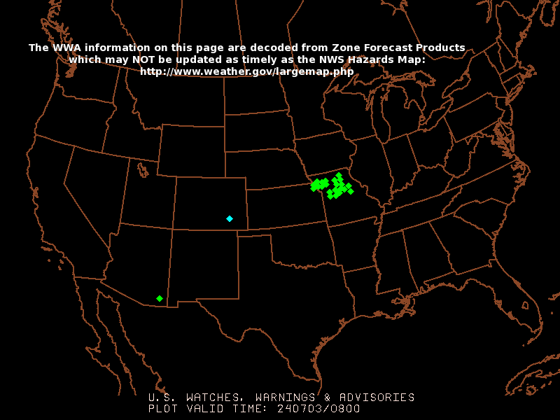
Five Tornado Watches and over a dozen Severe Thunderstorm Warnings are
already in effect.
]http://www.spc.noaa.gov/products/wwa/wwa.gif
-- =================================================================== Jesse Ferrell - Meteorologist / Webmaster / Founder - WeatherMatrix 5000 Weather Enthusiasts Can't Be Wrong! www.weathermatrix.net==================================================================== StormReports Email List -- TO UNSUBSCRIBE, EMAIL A BLANK MESSAGE TO: stormreports-unsubscribe{at}wxmatrix-membersonly ; For Options Including 1 Per Day, Temporary Suspending, And More, Visit This Web Address: http://wxmatrix-membersonly/group/stormreports/join THESE REPORTS ARE MADE PUBLIC ON THE WEATHERMATRIX.NET WEBSITE!
Thank you for using HandheldWeather.com's Handheld / PDA / Palm Content