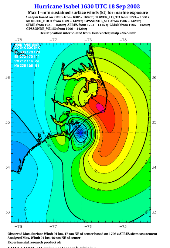
As a public service we are hosting the legacy H*wind archive that was formerly available through NOAA. Most of the archive was conducted in real-time so data collected after the analysis time were not available. Methods used to conduct the analyses evolved over the years. Grid spacing is on the order of 6 km and maximum domain size varies but is typically 8 x 8 degrees. There are known errors in some of the data coverage, mapping, and gridded products. For more information on the archive please go here. For realtime and post storm analysis of the 2014 season and a revised historical archive go here. |
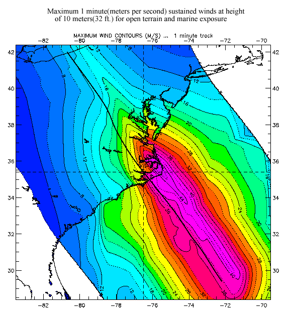
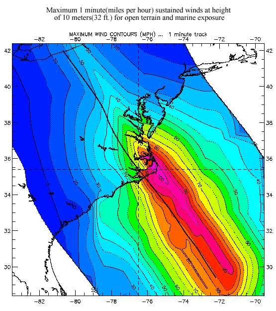
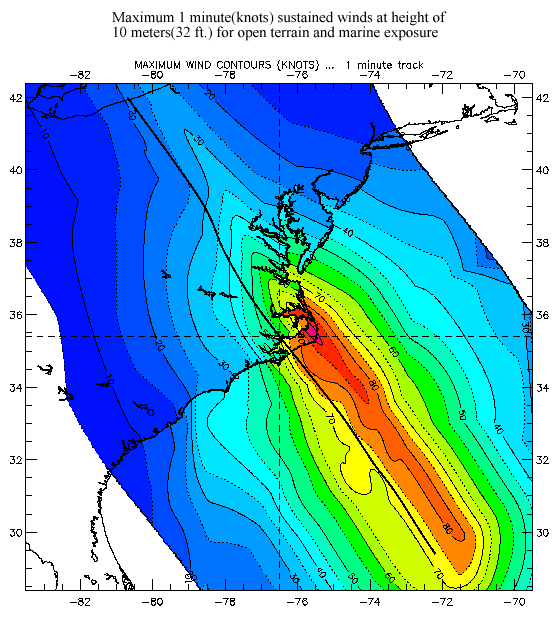
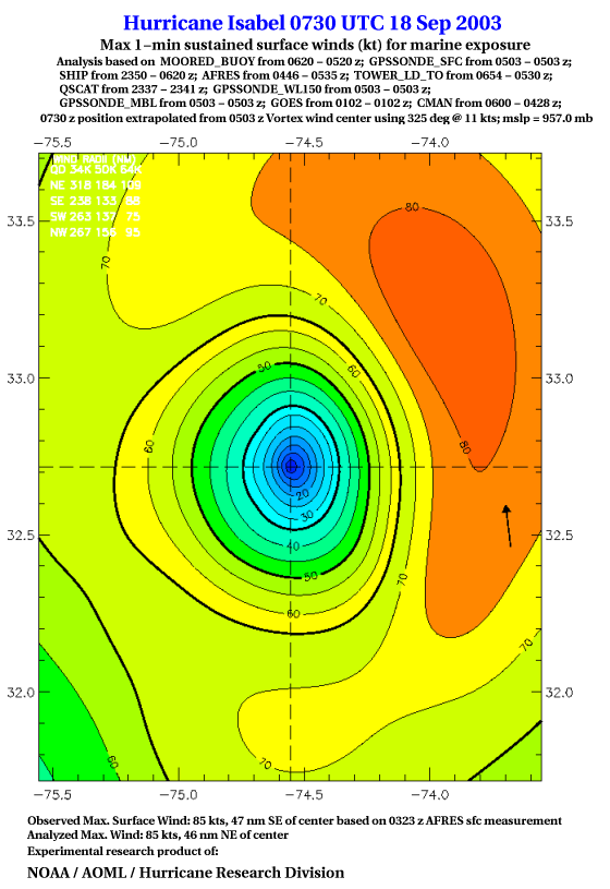
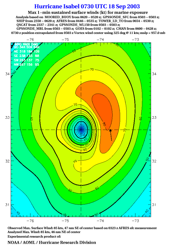
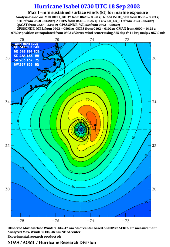
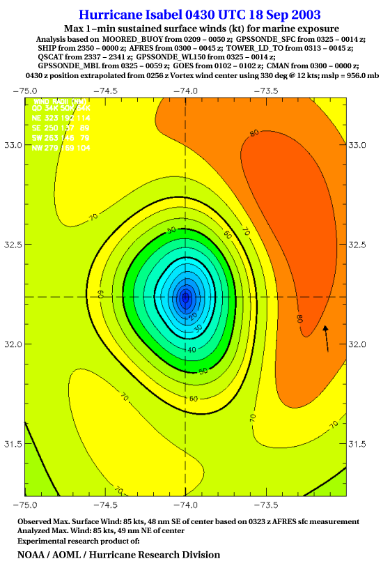
| The following maximum sustained wind swaths for ISABEL are preliminary results and will be subject to further modifications as new data become available. | |||||||||||||||
| in M/S | in MPH | in Knots | 4° map | 8° map | |||||||||||
| 2° map | 4° map | 8° map | |||||||||||||
| 2° map | 4° map | 8° map | |||||||||||||
| 2° map | 4° map | 8° map | |||||||||||||
| 2° map | 4° map | 8° map | |||||||||||||
| 2° map | 4° map | 8° map | |||||||||||||
| 2° map | 4° map | 8° map | |||||||||||||
| 2° map | 4° map | 8° map | |||||||||||||
| 2° map | 4° map | 8° map | |||||||||||||
| 2° map | 4° map | 8° map | |||||||||||||
| 2° map | 4° map | 8° map | |||||||||||||
| 2° map | 4° map | 8° map | |||||||||||||
| 2° map | 4° map | 8° map | |||||||||||||
| 2° map | 4° map | 8° map | |||||||||||||
| 2° map | 4° map | 8° map | |||||||||||||
| 2° map | 4° map | 8° map | |||||||||||||
| 2° map | 4° map | 8° map | |||||||||||||
| 2° map | 4° map | 8° map | |||||||||||||
| 2° map | 4° map | 8° map | |||||||||||||
| 2° map | 4° map | 8° map | |||||||||||||
| 2° map | 8° map | ||||||||||||||
| 2° map | 4° map | 8° map | |||||||||||||
| 2° map | 4° map | 8° map | |||||||||||||
| 2° map | 4° map | 8° map | |||||||||||||
| 2° map | 4° map | 8° map | |||||||||||||
| 2° map | 4° map | 8° map | |||||||||||||
| 2° map | 4° map | 8° map | |||||||||||||
| 2° map | 4° map | 8° map | |||||||||||||