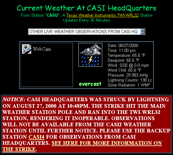
| NOTICE: THE
HEADQUARTERS OF THE CENTRAL ATLANTIC
STORM INVESTIGATORS WAS STRUCK BY LIGHTNING ON AUGUST 27, 2000
AT 10:48PM. THE STRIKE HIT THE MAIN WEATHER STATION POLE AND RAN
INTO THE TWI-WRL32 STATION, RENDERING IT INOPERABLE. OBSERVATIONS
WILL NOT BE AVAILABLE FROM THE CASI2
WEATHER STATION UNTIL FURTHER NOTICE. PLEASE USE THE BACKUP
STATION CASI4 FOR OBSERVATIONS
FROM CASI HEADQUARTERS. |
Additional information on the lightning
strike. Two severe thunderstorms came over CASI HQ between 10pm and
midnight on August 27. A Severe Thunderstorm
Warning was issued for our area of the county. We were the only
game in town; if you look at the AccuWeather.com
warning map, we were the only county under warnings at the time
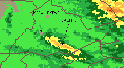
of the close strikes. See the radar
animation 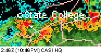 and
note where CASI HQ is pointed out on the map to the right (you are
looking near the center of the image). The storms came from the East,
which is extremely unusual here and may have helped their severity
(storms usually come from the West and decrease in strength when they
come off of the mountains). See the Intellicast.com
Radar Animation For Yesterday to see how the storms dodged us
early then came in from the east.
Three strikes hit VERY close (0 to 1/3 sec difference between the
lightning and thunder which would mean approx. 0-350 feet if you use
the counting
method) hit between 10:48 and approx. 11:15pm.
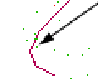 One
or more of these strikes apparently hit the 30 foot metal pole on
which the CASI2 Weather Station was installed. See the AccuWeather
Lightning Strike display map to the left. This map makes placement of
the strikes difficult because the only marker, the red line, is the
railroad. Click here for an expanded view.
I believe that either the strike that hit HQ was the one indicated by
the arrow, and the other two were the two that appear "on"
the railroad, or CASI HQ is the one on the right of the two "on"
the railroad and the third was the one just on the other side. I am
several hundred feet from the railroad but I am unsure of the scale of
the map.
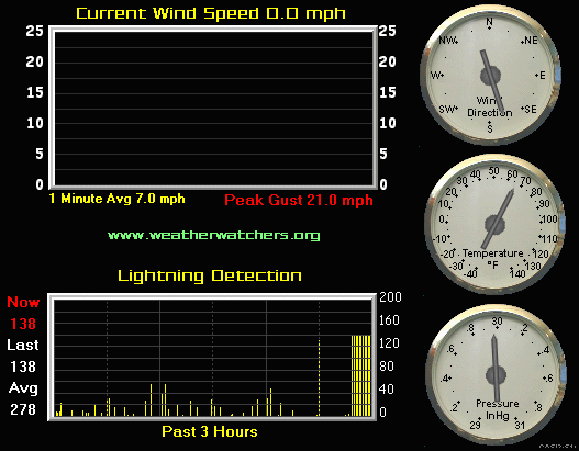
The Texas Weather Station froze at 10:48pm and
stopped responding. At that time it was rebooted but came up all 00's.
You can see below by the graph up to 11:00pm
(last Internet report by the station, still transmitted by the
software even though the station had stopped responding) that the
lightning counts had increased and steadied out at 138, not a high
level, but the consistency is interesting (a maximum of 358 counts was
reached at 10:42pm). 0.60" of rain also fell in an extremely
short amount of time before 10:48pm, totalling 1.73" according to
the CASI Backup Station CASI 4,
by the time it was all over. The KUNV airport, just miles away,
reported a mere .75". Check out the Storm Total Precipitation
graphic below (click here for zoom-out)
and note that the track of the storm(s) can be seen right over CASI HQ
with between 1.5-2.5" of precipitation in the area, which
verifies the CASI4 measurement.
The following morning I examined the pole from
the ground and did not see any obvious lightning damage, however the
pole was grounded several feet by a copper rod and lead so it's
possible that the lightning grounded itself with little damage,
although more may become apparent when I take down the pole next week
to install a different weather station. I don't know what else it
could have hit within 500 feet of the house as there is nothing else
which is well grounded in that range, other than power poles, but
there was no interruption in power and no other equipment *appears at
this time* to be damaged. Update: 8/29/00 : It was suggested
that the junction box on the pole was probably burnt out and that the
lightning probably did not even enter the console.
|