Current Weather At CASI HQ: Click Here For More Info |

| MAIN | STORM REPORTS | US SEVERE | MEMBERS | JOIN CASI | HELP/CONTACT | CAM |
|
Central |
|
|||||||
| Atlantic | |||||||||
| Storm | |||||||||
| I
n v e s t i g a t o r s |
|||||||||
|
|||||||||
|
Weather
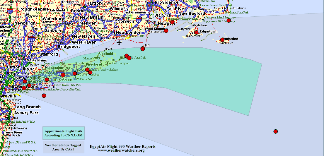
Data From The Contact was lost with EgyptAir Flight 990 off the coast of Massachusetts Oct 31 at approximately 3 am Eastern. Naturally one of the first things people think about after an airplane crash is weather conditions. Below is a map of Weather Observation Sites in the area; click on a dot for Current Weather Conditions (the search is ongoing). To see Archived Observations from crash time at these locations click here. For more information and specifics on the crash and investigation see CNN.com. The NTSB Report is not out as of 10/31 but it will appear on the NTSB October 1999 Mishap Page when it does. However, a Statement regarding EgyptAir Flight 990 is available. The map below addresses NWS and NWS Buoy stations. Stations not reporting in the last 24 hours were ignored. There were other stations in the area including AWS Long Island Observations and AWS Washington County RI Observations but this data was not archived.
|
© 1999 Central Atlantic Storm Investigators |