|
A very interesting temperature jump
occurred in an isolated area of Central Pennsylvania on the evening of
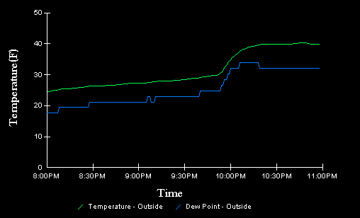
1/16/99. CASI Member Greg
Drollinger noted that he had a temperature/dewpoint jump just
after 10pm at his house in Watsontown, PA. The graph of that is below.
Now, knowing the problems that
electronic weather stations have, I wouldn't have believed it myself
but I checked the observations around the area - and Selinsgrove PA
reported a temperature of 32 at 10pm and 41 at 11pm. Now that in
itself is not that strange for a frontal passage (which we weren't
having), but the stations above and below Selinsgrove reported a
temperature FALL of 2 degrees those hours. See an image of the
10pm PA Temps and
11pm PA Temps. The KSEG temp
went back to 30 the next hour, and Greg's went back down to 35. If it
wasn't for Greg's report I would have thought the KSEG 11pm
temperature to be a typo (though the humidity did go down considerably
at that hour as well which may preclude a typo). There only
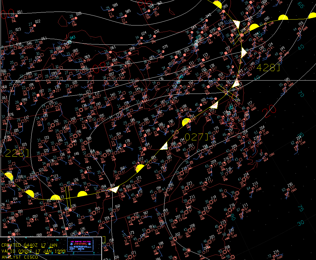
significant surface feature that evening was a front well south of the
area, as shown by the 03Z (10pm) Surface
Analysis from HPC.
Unless that baby flew north by a hundred miles then back to where it
was, I guess I'll chalk this one up to complex mesoscale processes.
SELINSGROVE, PA   8pm   35  84      0   29.95    10 PARTLY CLOUDY
                  9pm   34  92    S/3   29.96    10 OVERCAST
                 10pm   32 100  WNW/3   29.99     8 OVERCAST
                 11pm   41  75    N/5   30.01    10 CLEAR
12am 30 95 0 30.04 10 PARTLY CLOUDY |