Interesting case of unexpected localized flooding here, folks.


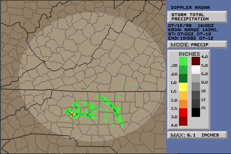
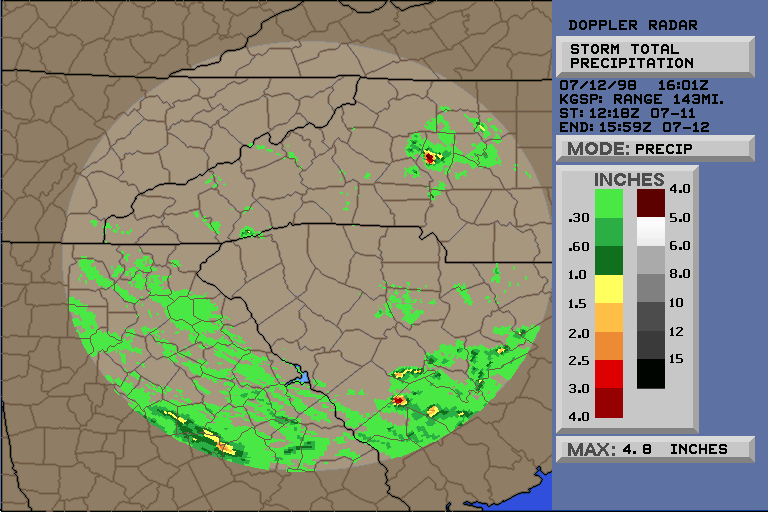
I have uploaded a couple NEXRAD Storm Precip images, from KROA and KGSP,

to the CASI site for perusal.  [SEE LINKS BELOW]


Quite impressive - Roanoke claims 6.1" since last night in a very small area!


-- Jesse
Ferrell


-----------------------------------------------------------------------


A tiny shower formed around 3 AM in Iredell County, NC this morning and

remained stationary for hours dropping moderate to heavy rainfall.  This

was a strange situation with surface parcels stable (CAPE of 0 and LIs

were positive) but convection still occurring and persisting.  I guess the

convection was rooted in a layer above the surface but no level was all

that unstable.  Additional shorter-lived showers have formed during the

day with very little movement indicated.


-- Tim Armstrong


----------------------------------------------------------------------

438

RWUS32 KGSP 121049

FFSGSP

NCZ036-121300-


FLASH FLOOD STATEMENT

NATIONAL WEATHER SERVICE GREENVILLE-SPARTANBURG SC

649 AM EDT SUN JUL 12 1998


A NEARLY STATIONARY RAINSHOWER HAS BEEN DUMPING VERY HEAVY RAINFALL

OVERNIGHT IN A SMALL PART OF WEST CENTRAL IREDELL COUNTY NORTH CAROLINA.

THE HEAVIEST RAINFALL...ESTIMATED BY RADAR IN EXCESS OF 4 INCHES...HAS

AFFECTED THE AREA ALONG AND JUST NORTH OF HIGHWAY US 64 IN THE VICINITY

OF THE COMMUNITIES OF SCOTTS AND LORAY.  THIS RAIN FELL SINCE ABOUT 3

AM.


LOW PLACES IN THIS AREA WILL LIKELY EXPERIENCE SOME FLOODING...AND

THERE COULD BE SOME FLOODING ALONG MORRISON CREEK AND THIRD CREEK...AND

PERHAPS OTHER SMALL STREAMS IN THE AREA.


MOTORISTS SHOULD WATCH CAREFULLY FOR FLOODED ROADS AND BRIDGES THIS

MORNING.  IF THE HEAVY RAINFALL PERSISTS...A FLASH FLOOD WARNING MAY BE

REQUIRED.

JONES
|