The NWS recorded a small weak tornado in Bellefonte PA, about 10 miles north of CASI HQ, at 5pm on May 29, 1998. Here are the Forecast Discussions and Special Weather Statements for CTP and surrounding offices during that morning. Additional information, such as specific Severe Thunderstorm or Tornado Warnings, can be found by digging through the CASI Severe Statements Archive
Meteorologist Jesse Ferrell traveled to Bellefonte PA on the following morning of May 30, 1998 to perform a Post Storm Investigation. Here is his report:
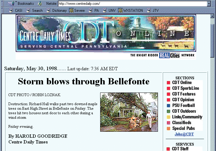
My first stop was 444 High Street, which was where two trees fell on two houses. It was taken in the same place as the picture on the front page of the Centre Daily Times, both Print and Online Edition. They don't keep past articles but you can read the article here and see a screen capture of their Online Edition.

Two large Maple trees appeared to have fallen onto two houses (Figure 1) and another recent stump existed in the back yard hinting at a third. The trees had been cleaned of the house at the left and were being removed from the one on the right. There looked to be some minimal damage to both houses.
I interviewed two men who were watching the proceedings. They noted that neither resident was home at the time the trees fell and that the wind was "very loud" that night.
This appeared to be the start of the damage although there were branches down behind the house, to the N and NW of the site. I was not able to investigate further to the North due to time constraints so I headed S and SE towards where the roads had been closed. Several roads were still closed at about 10am and reopened about 11am.
I zigzagged down East Cherry Lane. There were a few medium sized branches here but not a large number of branches or even twigs and leaves.
Crossing over 550 I saw another tree down. Going up Shope Street, there were a number of large branches there. A lady came out of her house and I quizzed her about the storm; she noted that "the power lines were whizzing" during the storm and that it was very scary indeed. Her son was out on his bicycle just before a large limb fell across the street.
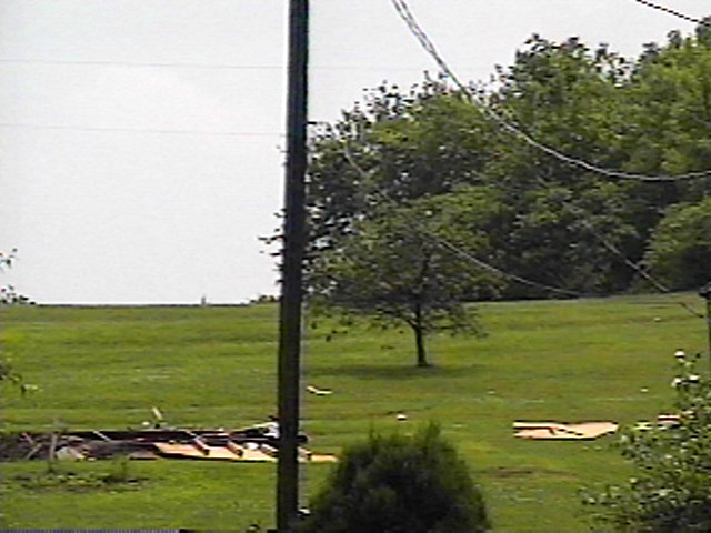
I doubled back to 550 in order to get up to the top of the hill, and took Crawford St, which is the top of the hill over looking the city, back to S. Alleghany Street and over to where I had parked. From Crawford, I could see a tree missing the top across a field on Forge Road.
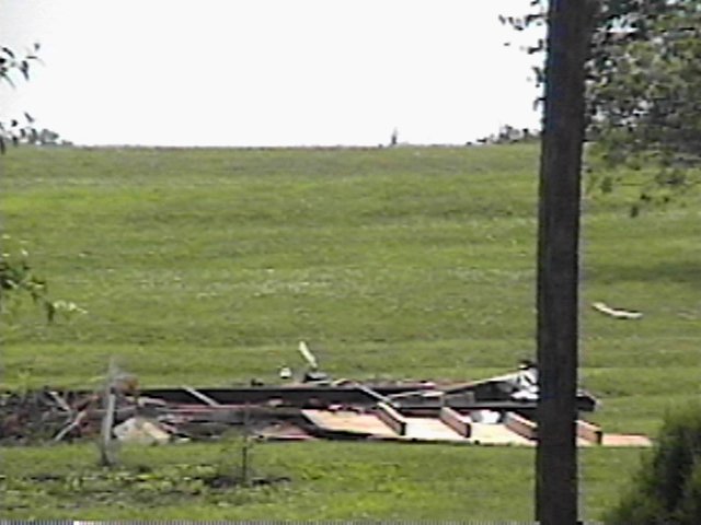
When leaving the area, I drove down Forge Road to take a better look at the large tree missing its top, which was in the same basic line as the previous damage. To the left of the tree appeared to be some small structural damage, perhaps a shack which had been taken apart during the storm, but it was hard to say if it was actually storm damage or not, and there was no one there to ask. (Figure 3) shows the debris and (Figure 4) is a closeup of where the small structure must have stood.
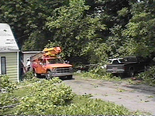
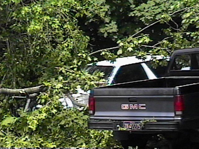
Driving away from Bellefonte on Blanchard St. I decided to take the last road off to the right to see if there was additional damage. There was indeed, keeping with the straight line path, on Grogry Street. I talked to the resident whose house is in (Figure 5) and (Figure 6) who reported that the top of the tree behind the utility truck in (Figure 5) had fallen onto the garage and cars, damaging three cars, two shown in (Figure 6), one already in the shop. It also cut his power and cable lines, which explained the utility truck.
II. Conclusions
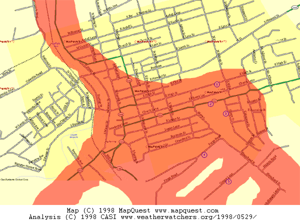
After getting home I wanted to map out the area we investigated
on a chart of compiled maps that I got from MapQuest.
See below.
|
Then I plotted the damage. See below. Click
on the chart below to receive a full map of Bellefonte with events plotted.
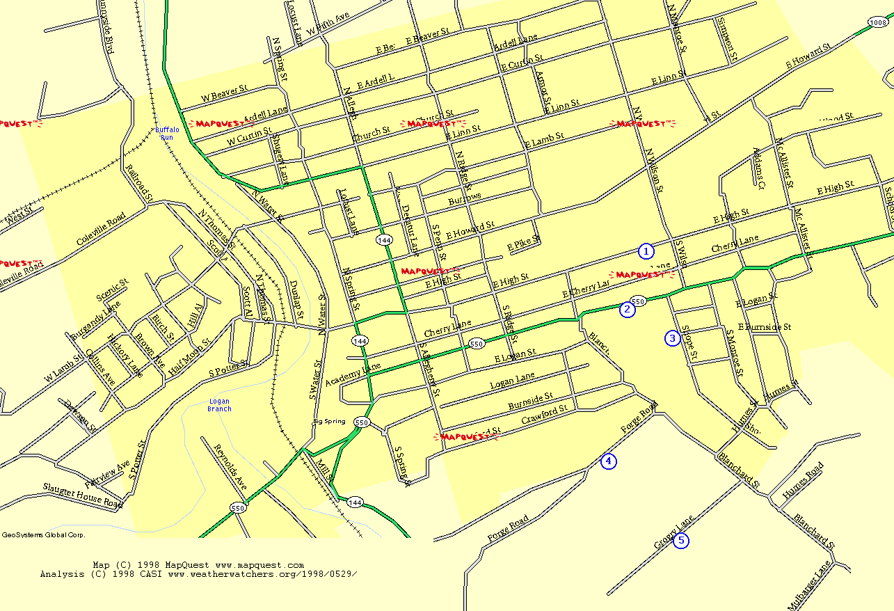 |
| (1) 444 E. High Street (TREES) - Figure 1
(2) Rd. 550 (TREE) (3) Shope Street (Branches) (4) Forge Road - Figures 3-4 (Treetop/Structure) (5) Grogry Lane - Figures 5-6 (Treetop) |
 |
||
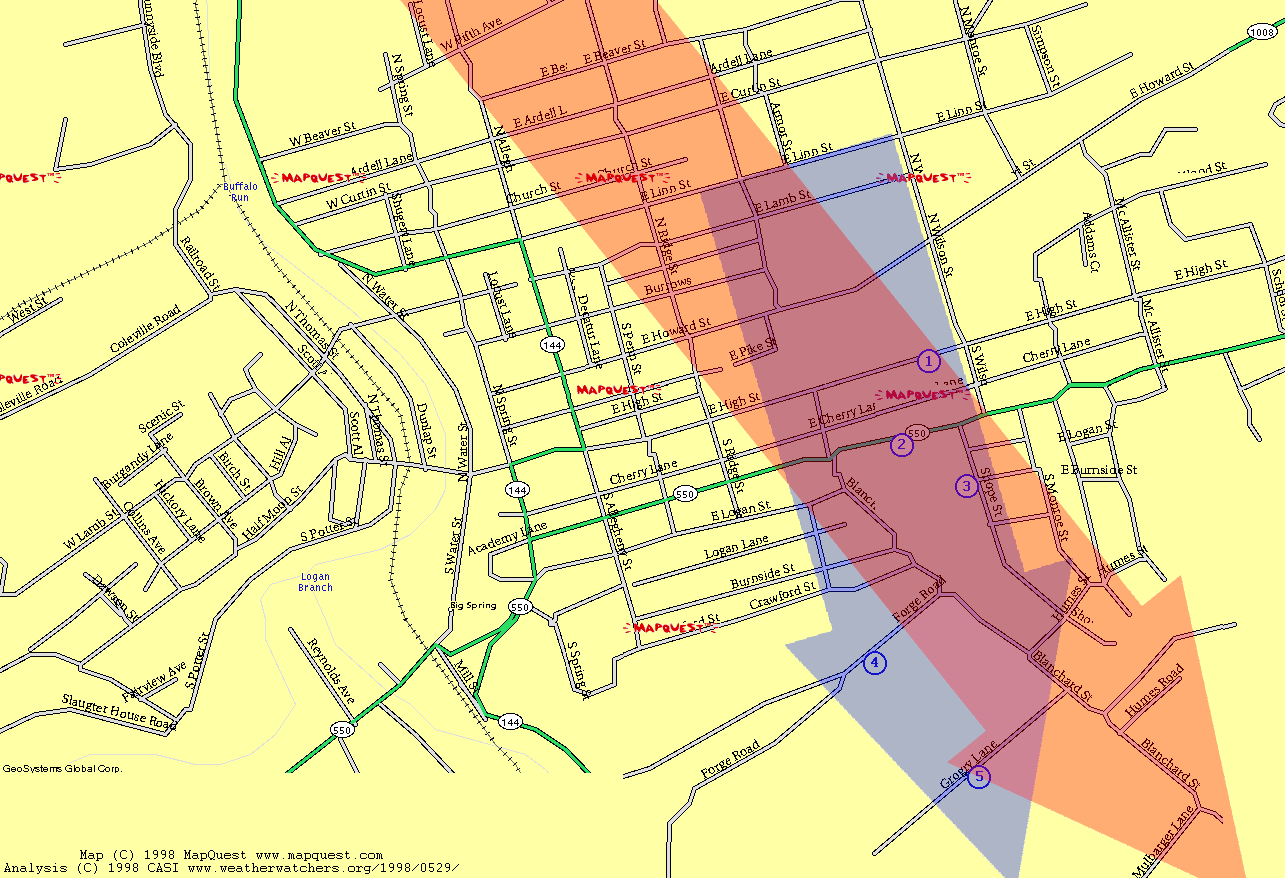
| CASI INVESTIGATION RESULTS
BELLEFONTE 5/29/98
Arrows indicate direction of travel. |
Notice that the areas more or less coincide, with NWS giving less note to areas (4) and (5), and with CASI's area not including some of the beginning area, which was partially in an area that we did not cover and was also in an area that had been cleaned up by Saturday morning when I was performing our investigation. The NWS arrow was plotted using information from the Public Info Statement.
The NWS's original Public Info Statement issued on Friday 5/29 evening indicated the path illustrated above and rated the storm an F0 Tornado. It wasn't clear to me why they had done this after the CASI investigation as what I saw (albeit after some cleanup) seemed to indicate a simple straight-line wind event. Reading further in the PNS I saw that the tornado classification was based on a spotter report of a funnel cloud. My assumption would be that this damage was caused by straight-line winds but there was an unrelated funnel cloud. NWS also labeled this a gustnado. For complete NWS discussion, see their site about this event.
Several days later, I heard that the NWS amended their report to call the event Straight Line Winds but I was not able to get ahold of a release confirming this.
I really enjoyed this investigation because it was just that: An old fashioned storm investigation. I stood like Frank Black on the hills of Bellefonte squinting into the sun, imagining "what must have happened." Flashes of imagination: the funnel cloud, the wind, the trees crashing down. I see what the storm sees. :)