
Central Atlantic
Storm Investigators
T h u n d e r s t o r m s
April 6, 1997
Central Atlantic
Storm Investigators

At 11am on this Sunday morning the NWS in Raleigh issued the following statement:
SEVERE WEATHER OUTLOOK FOR CENTRAL NORTH CAROLINA NATIONAL WEATHER SERVICE RALEIGH NC 11 AM EDT SUN APR 06 1997
(THE SEVERE WEATHER OUTLOOK FOR CENTRAL NORTH CAROLINA APPLIES ONLY TO THE COUNTIES LISTED AT THE END OF TEXT.)
SCATTERED THUNDERSTORMS ARE EXPECTED OVER THE AREA MAINLY THIS AFTERNOON AND EARLY TONIGHT. EVEN THOUGH THE THREAT OF SEVERE THUNDERSTORMS IS LOW...IT IS POSSIBLE THAT AN ISOLATED THUNDERSTORM COULD BECOME STRONG ENOUGH TO PRODUCE HIGH WINDS OR HAIL.
A COLD FRONT IN THE TENNESSEE VALLEY IS EXPECTED TO MOVE INTO NORTH CAROLINA LATER TODAY. AHEAD OF THIS FRONT AS IT APPROACHES...UNSTABLE CONDITIONS WILL DEVELOP OVER THE AREA THIS AFTERNOON AND EVENING. A WEAK UPPER LEVEL DISTURBANCE MOVING ACROSS THE AREA ALONG WITH PLENTY OF MOISTURE WILL AID IN PROVIDING ENERGY FOR THUNDERSTORM DEVELOPMENT. THE MAIN THREAT FROM THUNDERSTORMS WILL BE GUSTY WINDS.
SPOTTER ACTIVATION WILL NOT BE NEEDED.
STAY TUNED TO NOAA WEATHER RADIO FOR ADDITIONAL STATEMENTS OR POSSIBLE WATCHES AND WARNINGS.
So we were on the lookout for thunderstorm development. Shortly after this statement went out, so did the Raleigh radar (RAX) which stayed down until the next day.

It really didn't look like anything was going to develop when, shortly after 5pm, the frontal area of the rain area began to strengthen, forming a small squall line. See NW corner of first Nexrad picture.
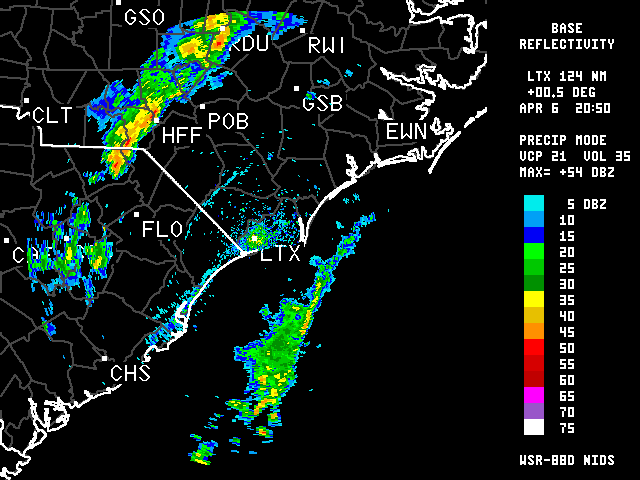
(Since RAX was out we were using LTX-Wilmington in a poor attempt to monitor the storms near RDU).

At 4:51pm, the RDU airport reported "Heavy Rain, Visibility 1 mile, Pressure Rising Rapidly" as a more intense area passed over them.
The squall line was beginning to show up on the lightning scan. Within 15 minutes, that area was here.
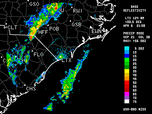
At 5:08 pm, a Cloud-to-Ground strike just to the North of HQ (saw it out the window) startled me, as I wasn't really expecting much thunder with these storms. After a couple of more close strikes, the 5:08 pm radar showed that a very small, compact area of 56db reflectivity had formed right over HQ!
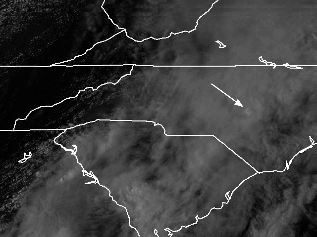
I swear if you plotted HQ on a map it would be right under that red dot. In addition, the overshooting top of the 56 db concentration could be seen on the visible satellite
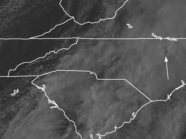
shot (I think the map is a little off of center) as it formed, then later (second shot) as it moved to the NE. The rain increased to very heavy with several more close lightning strikes before the cluster moved off to the NE.
I considered going for an LSI, but figured that it couldn't last and would be too hard to keep up with. This ended up to be a decent decision as it did not spawn any severe weather. The line moved to the NE on the border of both radars at MHX and ILM, and no further interesting Nexrad shots were captured.